From the Höllental valley to the summit of the Zugspitze
LOWA partner Ralf Stute talks about climbing Germany’s highest mountain on the route that leads through the Höllental valley
Germany The tour on the Höllental via ferrata [via-ferrata.de] is the “classic” route, so to speak, to the summit of the Zugspitze. It provides climbers with all sorts of fascinating sights provided by its sharply edged gorge, glacier and long via ferrata. Ralf Stute, the founder of the world’s largest via ferrata portal www.via-ferrata.de [via-ferrata.de], planned something special in August 2020 to mark the first ascent of Zugspitze 200 years ago: He decided to climb Germany’s highest mountain by a route that leads through the Höllental, or Hell’s Valley.

200 years ago was the first ascent of the Zugspitze
From the Höllental valley to the summit of the Zugspitze

The climb began in the dark at 5 a.m. at parking place 1 in Hammersbach. The forecast called for a sweat-inducing day of heat. By the time we reached the via ferrata leading to the summit, we were really feeling the 2,200 vertical metres that we were covering. If you are not planning to spend a night in the Höllental hut during a summer climb, it makes sense to set off early. That way, you will have enough time to catch the last cable car of the day.
We had reached the entrance of the Höllental gorge by the time that the first rays of sun appeared. The hub there is also open outside normal opening times, and we then stepped into “another world”. The Höllental gorge is a sharply edged canyon located between the mountains Alpspitze and Waxenstein. To your left and right, streams repeatedly appear as they plunge down the walls of the gorge. The splash of the tumbling water is almost deafening. Walking across wooden footpaths, over bridges and through tunnels carved into the mountainside, we climbed ever higher. Once we had exited the gorge, it took roughly a half-hour to reach the Höllental hut. After arriving there, we took a break, had a bite to eat and sized up the climb that still awaited us. At the end of the valley, we spotted the escarpment that would provide the photogenic setting for our climb on the well-tread passages “Leiter” (ladder) and “Brett” (board).
-
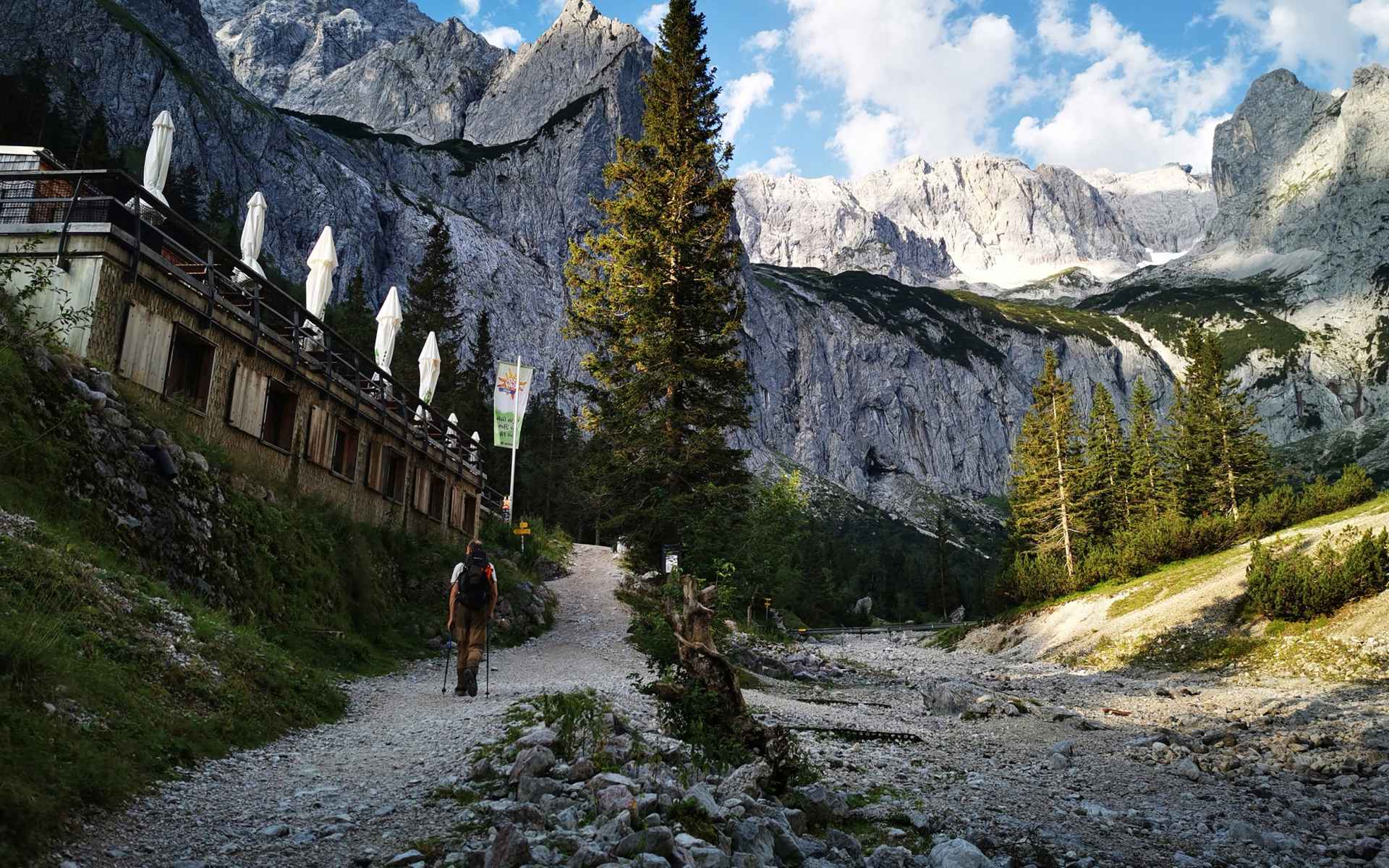
Taking a break at the Höllental hut.
After recharging our batteries, we began a hike took us to the end of the valley and the entrance to the Leiter passage in less than an hour. We strapped on our via ferrata gear here and took our place in the cue that had formed at the entrance. Waiting was not a problem for us. It gave us chance to take plenty of photos and videos. Walking in single file, we leisurely crossed these secured areas until we reached the rocky prongs of the Höllentalferner glacier. The gruelling, sweating-generating work then began as we manoeuvred our way across a huge rock-strewn field that led us to the snowy and icy remains of the Höllentalferner glacier.
We were fortunate today. The snow was extremely slushy, and we were up to our ankles in snow. That meant that we could keep the crampons that we took along for an emergency in our rucksacks. We then zig-zagged our way upwards until we reached the infamous crevasse that you have to cross before you can take on the final (and long) via ferrata. Quite a queue had already formed here as well, and we had to wait more than 20 minutes until we were able to use a relatively small snow bridge climb that had been built on the rock and offered the support of a steel cable. At this point, we had more than 600 vertical meters to climb until we reached the summit of the Zugspitze.

The final via ferrata
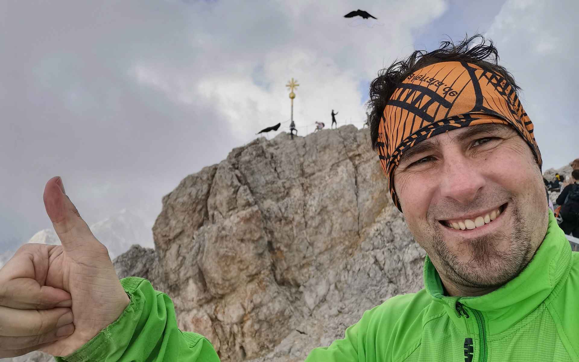
The final via ferrata is not especially difficult (maximum B/C). But it is long, and the heights are dizzying. Moving forwards ever so slowly and remaining in the caravan’s footsteps, we climbed vertical metre by vertical metre towards the summit of the Zugspitze until we had reached a spot just before the Irmerscharte viewing point where we caught our first glimpse of the Eibsee lake down below to our right [via-ferrata.de]. We were almost at our destination. When we reached the Irmerscharte, we needed less than 30 minutes to finish the climb to the summit cross, an object that we could now clearly see. It was the shot of motivation that we needed, and we finally reached the summit of Germany’s highest mountain at 2 p.m. after a climb that totalled nine hours (including breaks).
Conclusion: It was a great outing, one that you should certainly do! But you should not underestimate those 2,200 vertical metres and the situation on the glacier and the crevasse!
-
Ralf Stute
-

200 years ago was the first ascent of the Zugspitze